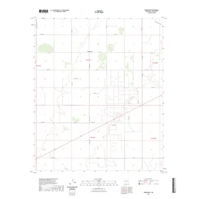
2023 Map of Prairieview
USGS Topo · Published 2023About this map
Prairieview anchors this high plains landscape in eastern New Mexico, situated within a rectilinear grid of county roads and section lines typical of Lea County. The terrain is characterized by subtle drainage patterns like McKenzie Draw and numerous small depressions and playas that dot the semi-arid environment. Local navigation is defined by a network of family and landmark-named routes such as Golleher Ln, Benham Ln, and Dickenson Ln. The map illustrates a transition between open range and organized rural settlement, where utility and access are prioritized through thoroughfares like Enterprise Rd and Simpson Rd. This modern survey details the contemporary division of land across Township 14 South and Township 15 South, showing how the petroleum and ranching industries continue to shape the geographic footprint of the region.
Find a feature on this map
29 named features on this map. Tap any name to fly to it.
Don’t see what you’re looking for? This feature index may not catch every label — zoom into the map to look around manually.
Map Details
Editions of this 2023 Prairieview Map
This is the sole edition of this map. No revisions or reprints were ever made.
Other maps of this area

1954 · Hobbs
USGS Topo · 1:250,000

1954 · Brownfield
USGS Topo · 1:250,000

1958 · Brownfield
USGS Topo · 1:250,000

1958 · Hobbs
USGS Topo · 1:250,000

1962 · Brownfield
USGS Topo · 1:250,000

1962 · Lovington
USGS Topo · 1:24,000

1962 · Lovington
USGS Topo · 1:62,500

1969 · Humble City NE
USGS Topo · 1:24,000

1970 · Prairieview
USGS Topo · 1:24,000

1970 · Prairieview NE
USGS Topo · 1:24,000