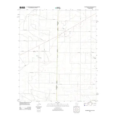
2012 Map of Prairieview SE
USGS Topo · Published 2012About this map
The high plains of the Llano Estacado are the defining landscape of this 2012 survey, where the border between Texas and New Mexico is demarcated by State Line Rd. The map reveals a region driven by agricultural and industrial utility, characterized by a grid of rural routes including Antioch Rd and Edwards Rd. Local social life and survival are marked by landmarks like the Antioch Baptist Church and a series of functional water sources such as the Mormon Windmill and East Farm Windmill. The presence of the W B D Oil Field underscores the significance of petroleum extraction in this corner of the Permian Basin, while the natural drainage of McKenzie Draw cuts across the otherwise structured road network.
Find a feature on this map
30 named features on this map. Tap any name to fly to it.
Don’t see what you’re looking for? This feature index may not catch every label — zoom into the map to look around manually.
Map Details
Editions of this 2012 Prairieview SE Map
This is the sole edition of this map. No revisions or reprints were ever made.
Other maps of this area

1954 · Hobbs
USGS Topo · 1:250,000

1954 · Brownfield
USGS Topo · 1:250,000

1958 · Brownfield
USGS Topo · 1:250,000

1958 · Hobbs
USGS Topo · 1:250,000

1962 · Brownfield
USGS Topo · 1:250,000

1969 · Humble City NE
USGS Topo · 1:24,000

1970 · Prairieview
USGS Topo · 1:24,000

1970 · Prairieview NE
USGS Topo · 1:24,000

1970 · Prairieview NW
USGS Topo · 1:24,000

1970 · Prairieview SE
USGS Topo · 1:24,000