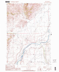
1988 Map of Pray
USGS Topo · Published 1988About this map
Paradise Valley serves as the focal point of this 1980s survey, defined by the winding course of the Yellowstone River. The landscape reveals a complex network of agricultural infrastructure, including the Paradise Canal, Park Branch Canal, and Highline Ditch, which redirect water across the valley floor. Settlement is concentrated around the small community of Pray, which sits near the southern end of the quadrangle. To the north, the terrain transitions into the foothills of Antelope Butte, where the Nesbit Cemetery and the settlement of Nesbit are located along Dry Creek. This map preserves the transition from traditional river-and-rail industry to a more modern rural layout, shown by the Old Railroad Grade running parallel to the river and the presence of the Arrowhead School and Community Church.
Find a feature on this map
21 named features on this map. Tap any name to fly to it.
Don’t see what you’re looking for? This feature index may not catch every label — zoom into the map to look around manually.
Map Details
Editions of this 1988 Pray Map
2 editions found
Other maps of this area

1891 · Livingston
USGS Topo · 1:250,000

1893 · Livingston
USGS Topo · 1:250,000

1947 · Bozeman
USGS Topo · 1:250,000

1948 · Bozeman
USGS Topo · 1:250,000

1951 · Bozeman Pass
USGS Topo · 1:62,500

1951 · Brisbin
USGS Topo · 1:24,000

1951 · Chimney Rock
USGS Topo · 1:24,000

1955 · Bozeman
USGS Topo · 1:250,000

1955 · Emigrant
USGS Topo · 1:62,500

1955 · Fridley Peak
USGS Topo · 1:62,500