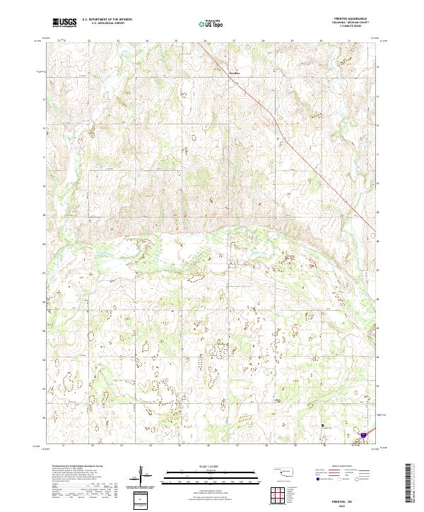
2022 Map of Prentiss
USGS Topo · Published 2022About this map
The Prentiss settlement area in Beckham County is defined by the braided channels and wide wetlands of the N Fork Red River. This Western Oklahoma landscape is deeply etched by a network of drainage systems, including Little Turkey Cr and Buffalo Cr, which flow through the sectioned plains. The map illustrates a classic Great Plains surveying pattern, where a rigid grid of section roads like E 1150 RD and E 1200 RD overlays a complex natural topography of creek breaks and river bottoms. In the southern reaches, the Pioneer Cem sits near the intersection of the modern 152 highway and Interstate 66, providing a specific point of interest for genealogists tracking early families in this borderland region between the Washita and Red River watersheds.
Find a feature on this map
27 named features on this map. Tap any name to fly to it.
Don’t see what you’re looking for? This feature index may not catch every label — zoom into the map to look around manually.
Map Details
Editions of this 2022 Prentiss Map
This is the sole edition of this map. No revisions or reprints were ever made.
Other maps of this area

1955 · Clinton
USGS Topo · 1:250,000

1957 · Clinton
USGS Topo · 1:250,000

1960 · Sweetwater
USGS Topo · 1:62,500

1960 · Sayre
USGS Topo · 1:62,500

1961 · Willow
USGS Topo · 1:62,500

1961 · Erick
USGS Topo · 1:62,500

1985 · Elk City
USGS Topo · 1:100,000
1988 · Grimes
USGS Topo · 1:24,000
1989 · Erick
USGS Topo · 1:24,000
1989 · Delhi
USGS Topo · 1:24,000