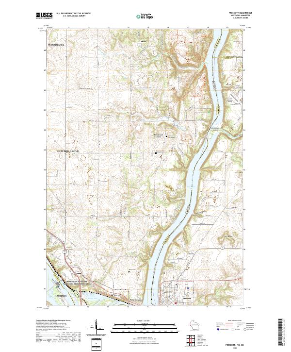
2022 Map of Prescott
USGS Topo · Published 2022About this map
The confluence of two major American waterways defines the landscape on this sheet, where the Mississippi River meets the Saint Croix Wild and Scenic River. Located at this strategic junction, Prescott serves as the focal point on the Wisconsin side, while Point Douglas and the southern edge of Afton occupy the Minnesota banks. The terrain is shaped by dramatic elevation changes along the river bluffs, evidenced by features like Clifton Hollow and Barkley Coulee.
Find a feature on this map
78 named features on this map. Tap any name to fly to it.
Don’t see what you’re looking for? This feature index may not catch every label — zoom into the map to look around manually.
Map Details
Editions of this 2022 Prescott Map
This is the sole edition of this map. No revisions or reprints were ever made.
Other maps of this area

1944 · Red Wing
USGS Topo · 1:62,500

1946 · Hudson
USGS Topo · 1:62,500

1946 · River Falls
USGS Topo · 1:62,500

1949 · River Falls
USGS Topo · 1:62,500

1949 · Hudson
USGS Topo · 1:62,500

1949 · Lake Elmo
USGS Topo · 1:24,000

1949 · Hudson
USGS Topo · 1:24,000

1950 · Lake Elmo
USGS Topo · 1:24,000

1950 · Hudson
USGS Topo · 1:24,000

1950 · St Paul Park
USGS Topo · 1:24,000