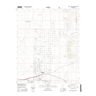
2014 Map of Prescott Valley North
USGS Topo · Published 2014About this map
Lonesome Valley and the expanding residential corridors of Prescott Valley define this landscape during the mid-2010s. The map illustrates a transitional geography where the high desert plains meet the western edge of the Prescott National Forest. Settlement patterns are characterized by an extensive grid of named rural roads, such as E Morning Star Ranch Rd and E Lonesome Valley Rd, reflecting the area's modern growth.
Find a feature on this map
102 named features on this map. Tap any name to fly to it.
Don’t see what you’re looking for? This feature index may not catch every label — zoom into the map to look around manually.
Map Details
Editions of this 2014 Prescott Valley North Map
This is the sole edition of this map. No revisions or reprints were ever made.
Other maps of this area

1887 · Prescott
USGS Topo · 1:250,000

1892 · Prescott
USGS Topo · 1:250,000

1905 · Jerome
USGS Topo · 1:125,000

1944 · Clarkdale
USGS Topo · 1:48,000

1944 · Mingus Mountain
USGS Topo · 1:62,500

1947 · Mingus Mtn
USGS Topo · 1:62,500

1947 · Paulden
USGS Topo · 1:62,500

1947 · Prescott
USGS Topo · 1:62,500

1948 · Prescott
USGS Topo · 1:62,500
1948 · Clarkdale
USGS Topo · 1:62,500