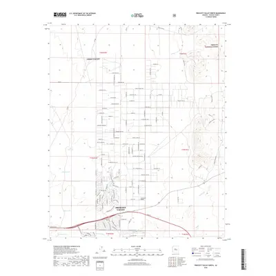
2018 Map of Prescott Valley North
USGS Topo · Published 2018About this map
Lonesome Valley dominates the central landscape of this survey, defining the high desert terrain between the burgeoning communities of Chino Valley to the northwest and Prescott Valley to the south. The transition from wide-open ranch land to residential development is evident in the emerging grid of streets and named ways north of the Aqua Fria River. Water management in this arid environment is highlighted by numerous catchment basins, including Black Hill Tank, Midway Tank, and Nelson Tank, which support the region's historic ranching operations. To the northeast, the terrain ascends into the Prescott National Forest, where the topography shifts from flat basin floors to the more complex drainage systems of Coyote Wash. The map documents a specific moment of suburban expansion into traditional cattle country, marked by thoroughfares such as Irwin Ranch Rd and Dog Ranch Rd.
Find a feature on this map
78 named features on this map. Tap any name to fly to it.
Don’t see what you’re looking for? This feature index may not catch every label — zoom into the map to look around manually.
Map Details
Editions of this 2018 Prescott Valley North Map
This is the sole edition of this map. No revisions or reprints were ever made.
Other maps of this area

1887 · Prescott
USGS Topo · 1:250,000

1892 · Prescott
USGS Topo · 1:250,000

1905 · Jerome
USGS Topo · 1:125,000

1944 · Clarkdale
USGS Topo · 1:48,000

1944 · Mingus Mountain
USGS Topo · 1:62,500

1947 · Mingus Mtn
USGS Topo · 1:62,500

1947 · Paulden
USGS Topo · 1:62,500

1947 · Prescott
USGS Topo · 1:62,500

1948 · Prescott
USGS Topo · 1:62,500
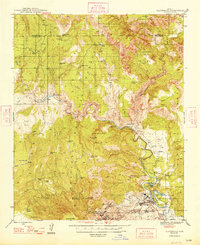
1948 · Clarkdale
USGS Topo · 1:62,500