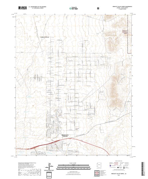
2021 Map of Prescott Valley North
USGS Topo · Published 2021About this map
Lonesome Valley dominates this high-desert landscape in Yavapai County, where residential expansion from Chino Valley and Prescott Valley meets the managed wilderness of the Prescott National Forest. The map documents a complex network of local roads with unique names like Windmill Acres Rd and Dog Ranch Rd, reflecting a shift from traditional ranching to modern rural living. The importance of water management in this arid environment is evident through several artificial reservoirs, including Black Hill Tank and Nelson Tank, as well as the significant Prescott-Jerome Waterway. The southern portion of the quadrangle shows the drainage of the Agua Fria River, a vital watercourse for the region’s development and natural ecology.
Find a feature on this map
122 named features on this map. Tap any name to fly to it.
Don’t see what you’re looking for? This feature index may not catch every label — zoom into the map to look around manually.
Map Details
Editions of this 2021 Prescott Valley North Map
This is the sole edition of this map. No revisions or reprints were ever made.
Other maps of this area

1887 · Prescott
USGS Topo · 1:250,000

1892 · Prescott
USGS Topo · 1:250,000

1905 · Jerome
USGS Topo · 1:125,000

1944 · Clarkdale
USGS Topo · 1:48,000

1944 · Mingus Mountain
USGS Topo · 1:62,500

1947 · Mingus Mtn
USGS Topo · 1:62,500

1947 · Paulden
USGS Topo · 1:62,500

1947 · Prescott
USGS Topo · 1:62,500

1948 · Prescott
USGS Topo · 1:62,500
1948 · Clarkdale
USGS Topo · 1:62,500