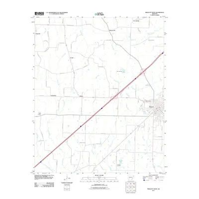
2011 Map of Prescott West
USGS Topo · Published 2011About this map
The city of Prescott anchors the eastern edge of this Arkansas landscape, where a transition occurs between the urban street grid and the rural creek systems of the west. Several small communities, including Arcadia, Midway, and Deanyville, define the settlement patterns of this era, connected by a network of county roads. These rural areas are deeply carved by a series of south-flowing waterways, such as Vickers Creek, Steel Creek, and Onion Creek. The presence of numerous family and community burial grounds, including Smyrna Cemetery and Artesian Cemetery, provides a clear view of the area's genealogical history. Man-made water features such as Hale Lake and Bee Bee Lake, both with identified dams, indicate local water management and recreation sites developed along the drainages of Garland Creek and Pine Creek during this period.
Find a feature on this map
73 named features on this map. Tap any name to fly to it.
Don’t see what you’re looking for? This feature index may not catch every label — zoom into the map to look around manually.
Map Details
Editions of this 2011 Prescott West Map
This is the sole edition of this map. No revisions or reprints were ever made.
Other maps of this area

1901 · Gurdon
USGS Topo · 1:125,000

1951 · Blevins
USGS Topo · 1:24,000

1951 · Pisgah
USGS Topo · 1:24,000

1951 · Hope
USGS Topo · 1:24,000

1953 · El Dorado
USGS Topo · 1:250,000

1957 · El Dorado
USGS Topo · 1:250,000

1958 · El Dorado
USGS Topo · 1:250,000

1960 · El Dorado
USGS Topo · 1:250,000

1970 · Prescott East
USGS Topo · 1:24,000
1970 · Prescott West
USGS Topo · 1:24,000