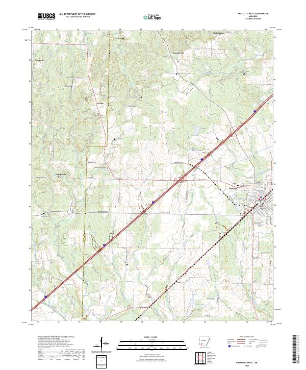
2024 Map of Prescott West
USGS Topo · Published 2024About this map
Prescott serves as the focal point of this southwestern Arkansas landscape, anchored by the Nevada County Courthouse. The surrounding rural territory is defined by a dense network of country roads and small settlements including Arcadia, Garlandville, and Deanyville. This 2024 survey captures the persistent rural infrastructure of the region, where numerous family and community burial grounds like Artesian Cem and Baird's Chapel Cem are tucked between the drainages of Steel Creek and May Creek. The map details a landscape where small-scale aviation at Head Airfield and local water bodies such as Bee Bee Lake coexist with the major transportation corridors that intersect the county seat. This documentation is particularly valuable for tracing the placement of rural landmarks and ecclesiastical sites that have defined local community boundaries for generations.
Find a feature on this map
115 named features on this map. Tap any name to fly to it.
Don’t see what you’re looking for? This feature index may not catch every label — zoom into the map to look around manually.
Map Details
Editions of this 2024 Prescott West Map
This is the sole edition of this map. No revisions or reprints were ever made.
Other maps of this area

1901 · Gurdon
USGS Topo · 1:125,000

1951 · Blevins
USGS Topo · 1:24,000

1951 · Pisgah
USGS Topo · 1:24,000

1951 · Hope
USGS Topo · 1:24,000

1953 · El Dorado
USGS Topo · 1:250,000

1957 · El Dorado
USGS Topo · 1:250,000

1958 · El Dorado
USGS Topo · 1:250,000

1960 · El Dorado
USGS Topo · 1:250,000

1970 · Prescott East
USGS Topo · 1:24,000
1970 · Prescott West
USGS Topo · 1:24,000