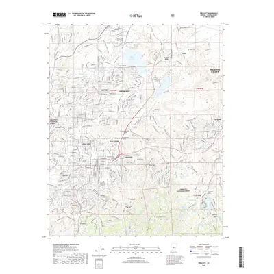
2018 Map of Prescott
USGS Topo · Published 2018About this map
Prescott National Cemetery and the grounds of Fort Whipple serve as central landmarks in this detailed view of the regional hub, where high-desert terrain meets established institutional history. The map documents a complex landscape of higher education, including Embry-Riddle Aeronautical University, Yavapai College, and Prescott College, alongside residential growth in Miller Valley and Juniper Heights. The distinct topography of the Granite Dells stands out near Willow Creek Reservoir and Watson Lake, illustrating how the town's expansion is shaped by its geological surroundings. Traces of historical transport and recreation are evident in the Peavine Trail and Iron King Trail, while family and fraternal history is preserved at the Independent Order of Odd Fellows Cemetery and the Arizona Pioneers Home Cemetery.
Find a feature on this map
251 named features on this map. Tap any name to fly to it.
Don’t see what you’re looking for? This feature index may not catch every label — zoom into the map to look around manually.
Map Details
Editions of this 2018 Prescott Map
This is the sole edition of this map. No revisions or reprints were ever made.
Other maps of this area

1887 · Prescott
USGS Topo · 1:250,000

1892 · Prescott
USGS Topo · 1:250,000

1903 · Bradshaw Mountains
USGS Topo · 1:125,000

1903 · Congress
USGS Topo · 1:125,000

1904 · Congress
USGS Topo · 1:125,000

1905 · Jerome
USGS Topo · 1:125,000

1947 · Iron Springs
USGS Topo · 1:62,500

1947 · Mt. Union
USGS Topo · 1:62,500

1947 · Kirkland
USGS Topo · 1:62,500

1947 · Prescott
USGS Topo · 1:62,500