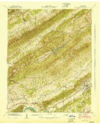
1940 Map of Pressmens Home
USGS Topo · Published 1940About this map
Stone Mountain and Chinch Mountain dominate this corner of Hawkins County, their parallel ridges defining the deep drainages of Poor Valley Creek and Cane Creek. The 1939 Tennessee Valley Authority field examination captures a landscape of localized mountain settlements and specialized institutions, most notably Pressmens Home, the headquarters of the International Printing Pressmen and Assistants' Union of North America. Near this campus, Memorial Chapel and Cobbs Chapel served the community along the Lee Highway corridor.
Find a feature on this map
54 named features on this map. Tap any name to fly to it.
Don’t see what you’re looking for? This feature index may not catch every label — zoom into the map to look around manually.
Map Details
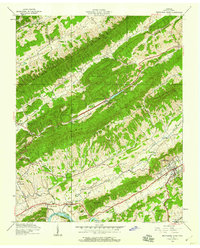
Editions of this 1940 Pressmens Home Map
2 editions found
Other maps of this area

1883 · Morristown
USGS Topo · 1:125,000

1887 · Jonesville
USGS Topo · 1:125,000

1891 · Jonesville
USGS Topo · 1:125,000

1892 · Greeneville
USGS Topo · 1:125,000

1893 · Morristown
USGS Topo · 1:125,000

1894 · Estillville
USGS Topo · 1:125,000

1895 · Morristown
USGS Topo · 1:125,000

1896 · Greeneville
USGS Topo · 1:125,000

1904 · Greeneville
USGS Topo · 1:125,000

1935 · Surgoinsville
USGS Topo · 1:48,000