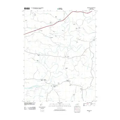
2010 Map of Preston
USGS Topo · Published 2010About this map
Slate Creek and its many tributaries, including Salt Well Creek, carve through the landscape of this Montgomery County region near the turn of the decade. The map reveals a high density of family-named cemeteries and small rural settlements that speak to the deep-rooted local genealogy of the area. Locations such as Stepstone, Peeled Oak, and Chestnut Grove are connected by a network of winding roads like Tapp Rd and Hart Grove Rd. Evidence of early community infrastructure is preserved through the Preston Post Office and Hope Post Office, while the Antioch Church and its adjacent Antioch Church Cemetery serve as central landmarks for the southern portion of the quadrangle. The presence of the Greenbrier Creek Reservoir and the One Oak Airport indicate the modern utility of the land alongside traditional agricultural sites like Old Forge Farm.
Find a feature on this map
82 named features on this map. Tap any name to fly to it.
Don’t see what you’re looking for? This feature index may not catch every label — zoom into the map to look around manually.
Map Details
Editions of this 2010 Preston Map
This is the sole edition of this map. No revisions or reprints were ever made.
Other maps of this area

1892 · Beattyville
USGS Topo · 1:125,000

1929 · Salt Lick
USGS Topo · 1:62,500

1934 · Salt Lick
USGS Topo · 1:62,500

1950 · Levee
USGS Topo · 1:24,000

1952 · Preston
USGS Topo · 1:24,000

1952 · Owingsville
USGS Topo · 1:24,000

1952 · Sharpsburg
USGS Topo · 1:24,000

1952 · Mount Sterling
USGS Topo · 1:24,000

1952 · Frenchburg
USGS Topo · 1:24,000

1952 · Means
USGS Topo · 1:24,000