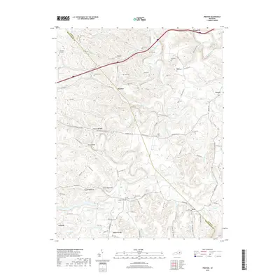
2019 Map of Preston
USGS Topo · Published 2019About this map
Jeffersonville and Owingsville anchor this 2019 landscape along the border of Bath and Montgomery Counties. The terrain is defined by a dense network of winding valleys and ridges, including Harpers Ridge and Indian Hill, drained by several branches of Slate Creek. This area maintains a strong rural character with numerous family-named burial grounds like Carpenter-Smith Cem and Goodpaster Cem scattered across the uplands. The road network follows the legacy of early settlements, with Howards Mill and Stepstone connected by routes that weave through deep hollows such as Foley Hollow and Davis Hollow. The presence of Antioch Church and the small One Oak Airport illustrates the mix of traditional community centers and modern local infrastructure. Genealogists will find significant value in the detailed placement of small cemeteries like Moore Cem and Kendall Springs Cem, which are often the only remaining markers of the area's earliest homesteads.
Find a feature on this map
95 named features on this map. Tap any name to fly to it.
Don’t see what you’re looking for? This feature index may not catch every label — zoom into the map to look around manually.
Map Details
Editions of this 2019 Preston Map
This is the sole edition of this map. No revisions or reprints were ever made.
Other maps of this area

1892 · Beattyville
USGS Topo · 1:125,000

1929 · Salt Lick
USGS Topo · 1:62,500

1934 · Salt Lick
USGS Topo · 1:62,500

1950 · Levee
USGS Topo · 1:24,000

1952 · Preston
USGS Topo · 1:24,000

1952 · Owingsville
USGS Topo · 1:24,000

1952 · Sharpsburg
USGS Topo · 1:24,000

1952 · Mount Sterling
USGS Topo · 1:24,000

1952 · Frenchburg
USGS Topo · 1:24,000

1952 · Means
USGS Topo · 1:24,000