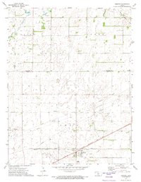
1971 Map of Preston
USGS Topo · Published 1974About this map
The Old Indian Treaty Boundary cuts through the southern portion of this landscape, marking a historical division just north of Preston. This agricultural region at the border of Stafford and Pratt counties is defined by a network of energy infrastructure and transit. Multiple segments of Pipeline and an extensive Oil Field populate the terrain, while the North Fork Ninnescah River and Silver Creek provide the primary drainage for the area's many depressions and small water bodies. Two major rail lines, the Chicago Rock Island and Pacific and the Missouri Pacific, converge near the townsite, reflecting the importance of rail transport for the local grain and oil industries. Genealogists will find the locations of Haynesville Cem and Friendship Cem particularly useful for tracing early residents of Union and York townships.
Find a feature on this map
18 named features on this map. Tap any name to fly to it.
Don’t see what you’re looking for? This feature index may not catch every label — zoom into the map to look around manually.
Map Details
Editions of this 1971 Preston Map
This is the sole edition of this map. No revisions or reprints were ever made.
Other maps of this area

1892 · Kingman
USGS Topo · 1:125,000

1892 · Pratt
USGS Topo · 1:125,000

1894 · Kingman
USGS Topo · 1:125,000

1894 · Pratt
USGS Topo · 1:125,000

1955 · Pratt
USGS Topo · 1:250,000

1959 · Pratt
USGS Topo · 1:250,000

1966 · Cunningham
USGS Topo · 1:24,000

1967 · Cairo
USGS Topo · 1:24,000

1968 · Pratt
USGS Topo · 1:24,000
1971 · Turon
USGS Topo · 1:24,000