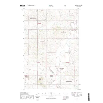
2017 Map of Pretty Butte
USGS Topo · Published 2017About this map
Little Missouri National Grassland dominates this portion of Slope County, where the high plains break into a complex network of drainage systems. The landscape is defined by the winding course of the Little Missouri River and the prominent landmark of Pretty Butte in the southern reaches. This modern survey illustrates the conservation and management of public lands, intersected by historical thoroughfares like Old 16 Rd and Indian Hills Trail Rd. The intricate hydrology of the region is evident in the many tributaries carving through the terrain, including Cannonball Creek, Mud Cr, and N Butte Cr. These watercourses reveal the erosion patterns characteristic of the western North Dakota badlands, providing a clear view of the geographic isolation and sparse settlement patterns that define this section of the state in the early twenty-first century.
Find a feature on this map
19 named features on this map. Tap any name to fly to it.
Don’t see what you’re looking for? This feature index may not catch every label — zoom into the map to look around manually.
Map Details
Editions of this 2017 Pretty Butte Map
This is the sole edition of this map. No revisions or reprints were ever made.
Other maps of this area

1953 · Miles City
USGS Topo · 1:250,000

1953 · Dickinson
USGS Topo · 1:250,000

1957 · Dickinson
USGS Topo · 1:250,000

1957 · Miles City
USGS Topo · 1:250,000

1958 · Miles City
USGS Topo · 1:250,000

1979 · Three V Crossing
USGS Topo · 1:24,000

1980 · Pretty Butte
USGS Topo · 1:24,000

1980 · Marmarth
USGS Topo · 1:24,000

1980 · Boyce Creek West
USGS Topo · 1:24,000

1980 · Belfield
USGS Topo · 1:100,000