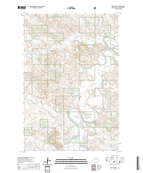
2024 Map of Pretty Butte
USGS Topo · Published 2024About this map
Little Missouri National Grassland dominates this corner of Slope County, preserving a complex drainage system where the Little Missouri River carves a winding path through the prairie. The landscape is defined by the namesake Pretty Butte, a prominent landmark that rises above the surrounding plains. A network of seasonal waterways, including Cannonball Creek, Cottonwood Creek, and Mud Creek, creates a dissected terrain typical of the North Dakota badlands. This modern survey illustrates the enduring rural character of the region, where historical routes like Old 16 Rd and the Indian Hills Trail Rd provide access through the vast public lands. The mapping reveals how the topography is influenced by the proximity of the river, with various draws such as North Butte Creek and Butte Creek feeding into the larger river valley.
Find a feature on this map
17 named features on this map. Tap any name to fly to it.
Don’t see what you’re looking for? This feature index may not catch every label — zoom into the map to look around manually.
Map Details
Editions of this 2024 Pretty Butte Map
This is the sole edition of this map. No revisions or reprints were ever made.
Other maps of this area

1953 · Miles City
USGS Topo · 1:250,000

1953 · Dickinson
USGS Topo · 1:250,000

1957 · Dickinson
USGS Topo · 1:250,000

1957 · Miles City
USGS Topo · 1:250,000

1958 · Miles City
USGS Topo · 1:250,000

1979 · Three V Crossing
USGS Topo · 1:24,000

1980 · Pretty Butte
USGS Topo · 1:24,000

1980 · Marmarth
USGS Topo · 1:24,000

1980 · Boyce Creek West
USGS Topo · 1:24,000

1980 · Belfield
USGS Topo · 1:100,000