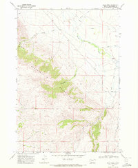
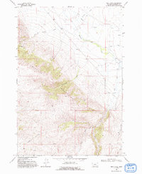
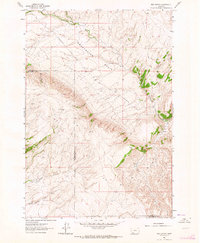
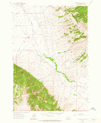
1968 Map of Price Creek
USGS Topo · Published 1972About this map
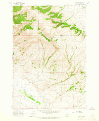
The Blacktail Mountains dominate this high-elevation terrain in Beaverhead County, Montana, as documented in 1968. The landscape is defined by its complex drainage network, where Blacktail Deer Creek and its many tributaries, such as Cottonwood Creek and Brock Creek, carve out steep canyons and ridges. Near the northwestern edge of the range, the Silver Queen Mine stands as a point of industrial interest, suggesting the area's mineral prospects during the late 1960s.
Find a feature on this map
17 named features on this map. Tap any name to fly to it.
Don’t see what you’re looking for? This feature index may not catch every label — zoom into the map to look around manually.
Map Details
Editions of this 1968 Price Creek Map
2 editions found
Other maps of this area

1893 · Dillon
USGS Topo · 1:250,000

1955 · Dubois
USGS Topo · 1:250,000

1955 · Dillon
USGS Topo · 1:250,000

1957 · Dillon
USGS Topo · 1:250,000

1958 · Dubois
USGS Topo · 1:250,000

1958 · Dillon
USGS Topo · 1:250,000
1961 · Red Canyon
USGS Topo · 1:24,000
1961 · Ashbough Canyon
USGS Topo · 1:24,000
1961 · Elk Gulch
USGS Topo · 1:24,000

1962 · Dillon
USGS Topo · 1:250,000