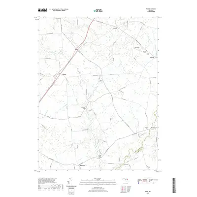
2019 Map of Price
USGS Topo · Published 2019About this map
Ruthsburg and Ingleside anchor this survey of the Eastern Shore's rural landscape, where the boundary between Queen Anne'S Co and Caroline Co follows the winding course of Mason Branch. The area is defined by a dense network of agricultural roads and watercourses, including German Branch and Jarmans Branch, which drain the low-lying terrain. Several small settlements such as Hayden, Hope, and Bridgetown are scattered throughout, often centered on historic crossroads like those found at Price.
Find a feature on this map
77 named features on this map. Tap any name to fly to it.
Don’t see what you’re looking for? This feature index may not catch every label — zoom into the map to look around manually.
Map Details
Editions of this 2019 Price Map
This is the sole edition of this map. No revisions or reprints were ever made.
Other maps of this area

1898 · Choptank
USGS Topo · 1:125,000

1898 · Tolchester
USGS Topo · 1:125,000

1899 · Dover
USGS Topo · 1:125,000

1901 · Chestertown
USGS Topo · 1:62,500

1903 · Tolchester
USGS Topo · 1:125,000

1904 · St. Michaels
USGS Topo · 1:62,500

1905 · Denton
USGS Topo · 1:62,500

1905 · Barclay
USGS Topo · 1:62,500

1906 · Dover
USGS Topo · 1:125,000

1908 · Tolchester
USGS Topo · 1:125,000