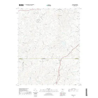
2019 Map of Price
USGS Topo · Published 2019About this map
Price sits at the intersection of local history and topography along the border of North Carolina and Virginia. The landscape is defined by the convergence of the North Mayo River and South Mayo River, which carve through a terrain marked by prominent elevations like Chestnut Knob and Holt Mtn. This area in Rockingham County is characterized by its rural settlement patterns, where small communities and family landmarks are anchored by sites such as Anglins Bridge and the Price Cem.
Find a feature on this map
88 named features on this map. Tap any name to fly to it.
Don’t see what you’re looking for? This feature index may not catch every label — zoom into the map to look around manually.
Map Details
Editions of this 2019 Price Map
This is the sole edition of this map. No revisions or reprints were ever made.
Other maps of this area

1924 · Martinsville
USGS Topo · 1:48,000

1926 · Martinsville
USGS Topo · 1:62,500

1926 · Critz
USGS Topo · 1:48,000

1927 · Martinsville
USGS Topo · 1:62,500

1928 · Critz
USGS Topo · 1:62,500

1944 · Martinsville
USGS Topo · 1:62,500

1953 · Winston-Salem
USGS Topo · 1:250,000

1953 · Greensboro
USGS Topo · 1:250,000

1954 · Greensboro
USGS Topo · 1:250,000

1955 · Winston-Salem
USGS Topo · 1:250,000