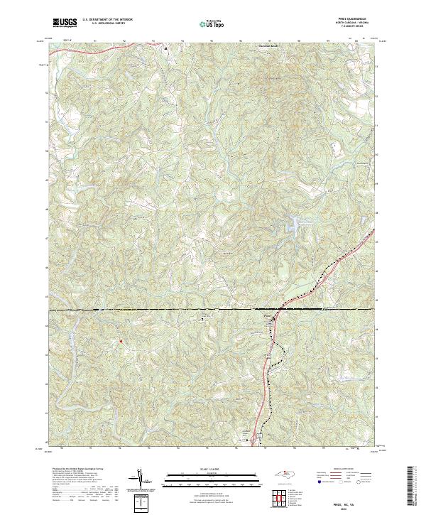
2022 Map of Price
USGS Topo · Published 2022About this map
The Virginia-North Carolina state line bisects this landscape, separating Rockingham County from Henry County. The settlement of Price serves as a central point in this rural borderland, where the Price United Methodist Church Cem and Christian View Cem offer significant data points for genealogists. The terrain is defined by the convergence of the North Mayo River and South Mayo River, which flow south out of the Virginia foothills. High points such as Chestnut Knob and Holt Mtn overlook a network of small drainages including Stillhouse Run and Matrimony Cr. The presence of Pace Airport and the Marrowbone Reservoir indicates the integration of modern infrastructure into a traditionally agricultural region, while local roads like Horsepasture Price Rd and Moores Mill Rd trace the paths of long-established community connections.
Find a feature on this map
90 named features on this map. Tap any name to fly to it.
Don’t see what you’re looking for? This feature index may not catch every label — zoom into the map to look around manually.
Map Details
Editions of this 2022 Price Map
This is the sole edition of this map. No revisions or reprints were ever made.
Other maps of this area

1924 · Martinsville
USGS Topo · 1:48,000

1926 · Martinsville
USGS Topo · 1:62,500

1926 · Critz
USGS Topo · 1:48,000

1927 · Martinsville
USGS Topo · 1:62,500

1928 · Critz
USGS Topo · 1:62,500

1944 · Martinsville
USGS Topo · 1:62,500

1953 · Winston-Salem
USGS Topo · 1:250,000

1953 · Greensboro
USGS Topo · 1:250,000

1954 · Greensboro
USGS Topo · 1:250,000

1955 · Winston-Salem
USGS Topo · 1:250,000