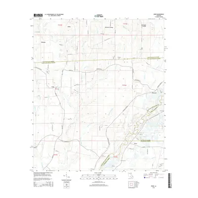
2015 Map of Pride
USGS Topo · Published 2015About this map
McKnight Crossing and Reiley anchor the northern landscape of this region where the Louisiana parishes of East Feliciana, East Baton Rouge, St. Helena, and Livingston all converge. The Amite River meanders through the eastern portion of the map, defining a boundary characterized by dense drainage networks including Beaver Pond Bayou and Spillers Cr. This modern survey illustrates how local commerce and community life are organized around primary routes like Greenwell Springs Rd and Pride Baywood Rd, connecting the larger settlement of Pride with outlying areas such as Weiss. Genealogy researchers will find significant value in the distribution of family and community landmarks, such as South Union Cem, Mahoney Cem, and the Stoner Cem, which sit alongside historic road names like Lee Price Rd and Ezra Courtney Ln.
Find a feature on this map
84 named features on this map. Tap any name to fly to it.
Don’t see what you’re looking for? This feature index may not catch every label — zoom into the map to look around manually.
Map Details
Editions of this 2015 Pride Map
This is the sole edition of this map. No revisions or reprints were ever made.
Other maps of this area

1906 · Bayou Sara
USGS Topo · 1:125,000

1939 · Zachary
USGS Topo · 1:62,500

1941 · Gilead
USGS Topo · 1:31,680

1942 · Pine Grove
USGS Topo · 1:31,680

1942 · Pride
USGS Topo · 1:31,680

1942 · Gilead
USGS Topo · 1:31,680

1942 · Watson
USGS Topo · 1:31,680

1942 · Satsuma
USGS Topo · 1:31,680

1946 · Clinton
USGS Topo · 1:31,680

1949 · Bluff Creek
USGS Topo · 1:31,680