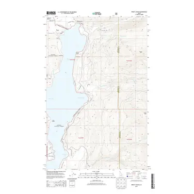
2013 Map of Priest Lake NE
USGS Topo · Published 2013About this map
Priest Lake dominates this portion of Kaniksu National Forest, where the eastern shoreline is defined by deep inlets like Distillery Bay, Huckleberry Bay, and Bear Creek Bay. The map documents a rugged landscape managed for recreation and conservation, featuring the Priest Lake State Park Lionhead Unit at the northern reaches of the lake. Higher elevations to the east are marked by prominent peaks such as Klootch Mtn and Goblin Knob, overlooking a network of drainages including Lion Cr and Two-Mouth Cr.
Find a feature on this map
49 named features on this map. Tap any name to fly to it.
Don’t see what you’re looking for? This feature index may not catch every label — zoom into the map to look around manually.
Map Details
Editions of this 2013 Priest Lake NE Map
This is the sole edition of this map. No revisions or reprints were ever made.
Other maps of this area

1911 · Priest Lake
USGS Topo · 1:250,000

1913 · Priest Lake
USGS Topo · 1:250,000

1958 · Sandpoint
USGS Topo · 1:250,000

1963 · Sandpoint
USGS Topo · 1:250,000

1967 · Priest Lake SE
USGS Topo · 1:24,000

1967 · Priest Lake NE
USGS Topo · 1:24,000

1967 · Priest Lake NW
USGS Topo · 1:24,000

1967 · The Wigwams
USGS Topo · 1:24,000

1967 · Mount Roothaan
USGS Topo · 1:24,000
1967 · Priest Lake SW
USGS Topo · 1:24,000