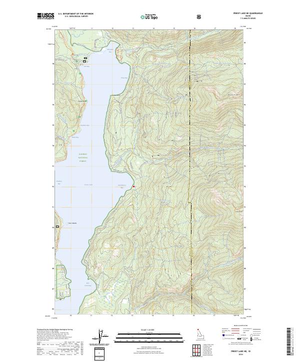
2024 Map of Priest Lake NE
USGS Topo · Published 2024About this map
The northeastern shoreline of Priest Lake in the Kaniksu National Forest is defined by a succession of deep-water bays and prominent landforms. Landmarks such as Canoe Point and Tripod Point break the coastline, sheltering waters like Mosquito Bay, Tule Bay, and Teachers Bay. The interior landscape rises sharply to the east, reaching summits at Klootch Mtn and Goblin Knob. A network of forest and access roads, including E Shore Rd and State Cabin Rd, facilitates movement along the lake's edge, while the Navigation Trl offers deeper access into the timber. Numerous drainages such as Two Mouth Creek and Lion Creek feed the lake from the high ridges, illustrating the complex watershed of this northern Idaho wilderness.
Find a feature on this map
50 named features on this map. Tap any name to fly to it.
Don’t see what you’re looking for? This feature index may not catch every label — zoom into the map to look around manually.
Map Details
Editions of this 2024 Priest Lake NE Map
This is the sole edition of this map. No revisions or reprints were ever made.
Other maps of this area

1911 · Priest Lake
USGS Topo · 1:250,000

1913 · Priest Lake
USGS Topo · 1:250,000

1958 · Sandpoint
USGS Topo · 1:250,000

1963 · Sandpoint
USGS Topo · 1:250,000

1967 · Priest Lake SE
USGS Topo · 1:24,000

1967 · Priest Lake NE
USGS Topo · 1:24,000

1967 · Priest Lake NW
USGS Topo · 1:24,000

1967 · The Wigwams
USGS Topo · 1:24,000

1967 · Mount Roothaan
USGS Topo · 1:24,000
1967 · Priest Lake SW
USGS Topo · 1:24,000