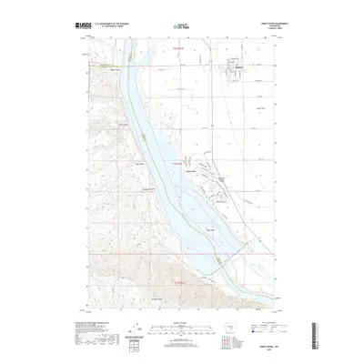
2020 Map of Priest Rapids
USGS Topo · Published 2020About this map
Mattawa and the riverside development of Desert Aire occupy a critical bend in the Columbia River, where the landscape shifts from the steep ravines of the west bank to the broad agricultural expanses of the Wahluke Slope to the east. This modern survey illustrates a highly structured grid of residential and recreational planning, particularly around the Desert Aire Regional Airport and its accompanying golf course layout. The river itself forms the primary geographical divider, broadening into Priest Rapids Lake as it approaches the southern ridge.
Find a feature on this map
50 named features on this map. Tap any name to fly to it.
Don’t see what you’re looking for? This feature index may not catch every label — zoom into the map to look around manually.
Map Details
Editions of this 2020 Priest Rapids Map
This is the sole edition of this map. No revisions or reprints were ever made.
Other maps of this area

1912 · Beverly
USGS Topo · 1:62,500

1917 · Priest Rapids
USGS Topo · 1:62,500

1936 · Hog Ranch Buttes
USGS Topo · 1:48,000

1939 · Boylston
USGS Topo · 1:48,000

1941 · Black Rock Spring
USGS Topo · 1:62,500

1943 · Boylston
USGS Topo · 1:62,500

1948 · Cairn Hope Peak
USGS Topo · 1:24,000

1948 · Emerson Nipple
USGS Topo · 1:24,000

1948 · Priest Rapids
USGS Topo · 1:24,000

1950 · Yakima
USGS Topo · 1:250,000