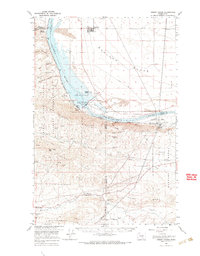
1965 Map of Priest Rapids
USGS Topo · Published 1966About this map
Mattawa and the surrounding Columbia River valley are defined by the mid-century intersection of massive hydroelectric development and federal installations. The centerpiece of this 1960s landscape is the Priest Rapids Dam, complete with its Powerhouse and Fish Ladder, which significantly altered the flow of the Columbia River near Goose Island. To the south and west, the terrain rises into the Umtanum Ridge and Yakima Ridge, where the sprawling Yakima Military Reservation occupies a significant portion of the highland. The presence of the Hanford Works at the eastern edge and the Chicago Milwaukee St Paul and Pacific railroad tracks following the river's bend illustrate a region vital to both national infrastructure and the Pacific Northwest's energy grid. Scattered ranching and mining operations, such as Meeboor Ranch and the Pozzolana Mine, represent the more traditional industries persisting amidst these large-scale changes.
Find a feature on this map
36 named features on this map. Tap any name to fly to it.
Don’t see what you’re looking for? This feature index may not catch every label — zoom into the map to look around manually.
Map Details
Editions of this 1965 Priest Rapids Map
This is the sole edition of this map. No revisions or reprints were ever made.
Other maps of this area

1910 · Zillah
USGS Topo · 1:125,000

1911 · Red Rock
USGS Topo · 1:62,500

1912 · Beverly
USGS Topo · 1:62,500

1915 · Prosser
USGS Topo · 1:125,000

1916 · Coyote Rapids
USGS Topo · 1:62,500

1917 · Priest Rapids
USGS Topo · 1:62,500

1917 · Prosser
USGS Topo · 1:125,000

1936 · Hog Ranch Buttes
USGS Topo · 1:48,000

1939 · Boylston
USGS Topo · 1:48,000

1941 · Black Rock Spring
USGS Topo · 1:62,500