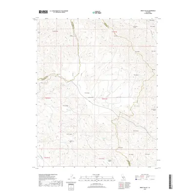
2018 Map of Priest Valley
USGS Topo · Published 2018About this map
The San Andreas Fault cuts a diagonal path through this portion of the Diablo Range, defining the complex tectonic landscape along the borders of Monterey, San Benito, and Fresno Counties. At the center of this drainage network lies Priest Valley, where Priest Valley Rd follows the course of Lewis Cr as it flows toward the south. The topography is defined by prominent elevations such as Mustang Ridge and Twin Peaks, creating a series of isolated basins including Charley Valley and Monroe Valley.
Find a feature on this map
46 named features on this map. Tap any name to fly to it.
Don’t see what you’re looking for? This feature index may not catch every label — zoom into the map to look around manually.
Map Details
Editions of this 2018 Priest Valley Map
This is the sole edition of this map. No revisions or reprints were ever made.
Other maps of this area

1915 · Priest Valley
USGS Topo · 1:125,000

1941 · Priest Valley
USGS Topo · 1:62,500

1941 · San Ardo
USGS Topo · 1:62,500

1943 · New Idria
USGS Topo · 1:62,500

1943 · San Ardo
USGS Topo · 1:62,500

1943 · Hernandez Valley
USGS Topo · 1:62,500

1944 · Hernandez Valley
USGS Topo · 1:62,500

1944 · Priest Valley
USGS Topo · 1:62,500

1948 · Santa Cruz
USGS Topo · 1:250,000

1955 · Santa Cruz
USGS Topo · 1:250,000