
1963 Map of Primrose
USGS Topo · Published 1967About this map
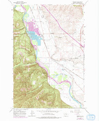
The Clark Fork river serves as a primary corridor through this Montana landscape, where the valley floor transitions into the steep slopes of the Lolo National Forest. This 1963 survey captures a period of active transportation and water management, illustrated by the presence of both the Northern Pacific and the Chicago Milwaukee St Paul and Pacific railroads. Irrigation systems like the Frenchtown Irrigation District Ditch and the Grass Valley French Ditch reveal the agricultural infrastructure required to support settlements such as Schilling and Primrose. The map documents local landmarks like the Grass Valley Sch and the Sherman Gulch Beacon, while industrial activities are marked by the Schilling Gravel Pit. Steep ravines like Cyr Gulch and Martin Gulch define the western terrain, contrasting with the open expanse of Big Flat.
Find a feature on this map
34 named features on this map. Tap any name to fly to it.
Don’t see what you’re looking for? This feature index may not catch every label — zoom into the map to look around manually.
Map Details
Editions of this 1963 Primrose Map
2 editions found
Other maps of this area

1912 · Missoula
USGS Topo · 1:125,000

1956 · Wallace
USGS Topo · 1:250,000

1956 · Hamilton
USGS Topo · 1:250,000

1959 · Hamilton
USGS Topo · 1:250,000

1959 · Alberton
USGS Topo · 1:62,500

1959 · Arlee
USGS Topo · 1:62,500

1960 · Wallace
USGS Topo · 1:250,000

1960 · Hamilton
USGS Topo · 1:250,000

1964 · Hamilton
USGS Topo · 1:250,000
1964 · Diamond Point
USGS Topo · 1:24,000