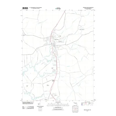
2011 Map of Princess Anne
USGS Topo · Published 2011About this map
The University of Maryland Eastern Shore campus dominates the northeastern landscape of this Somerset County seat. The town center of Princess Anne is defined by a traditional grid of streets and institutional landmarks including the Princess Anne Post Office and the Antioch Cemetery. Waterways define the local geography, with the Manokin River and its various branches, such as Taylor Branch and Loretta Branch, winding through the coastal plain toward the Chesapeake. To the south, the sprawling grounds of the Eastern Correctional Institution and Landon Station reflect the modern infrastructure of the region. The map also captures the outlying hamlets of Palmetto and Westover, which remain connected to the central hub by a network of rural routes like Revells Neck Rd and Stewart Neck Rd, tracing the boundaries of long-established necks and agricultural land.
Find a feature on this map
78 named features on this map. Tap any name to fly to it.
Don’t see what you’re looking for? This feature index may not catch every label — zoom into the map to look around manually.
Map Details
Editions of this 2011 Princess Anne Map
This is the sole edition of this map. No revisions or reprints were ever made.
Other maps of this area

1901 · Salisbury
USGS Topo · 1:62,500

1903 · Nanticoke
USGS Topo · 1:62,500

1903 · Deal Island
USGS Topo · 1:62,500

1942 · Marion
USGS Topo · 1:24,000

1942 · Monie
USGS Topo · 1:24,000

1942 · Wetipquin
USGS Topo · 1:24,000

1942 · Kingston
USGS Topo · 1:24,000

1942 · Princess Anne
USGS Topo · 1:24,000

1942 · Eden
USGS Topo · 1:24,000

1942 · Dividing Creek
USGS Topo · 1:24,000