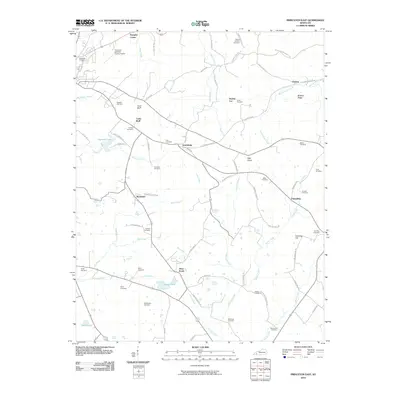
2010 Map of Princeton East
USGS Topo · Published 2010About this map
Otter Pond and the headwaters of Battle Creek anchor this landscape east of Princeton, where the rural character of Caldwell County is defined by a network of family-named cemeteries and scattered small settlements. The terrain transitions from the elevations of Wildcat Ridge and Bald Knob in the north toward the lower drainage basins of Millwood Creek and Craven Creek in the south.
Find a feature on this map
77 named features on this map. Tap any name to fly to it.
Don’t see what you’re looking for? This feature index may not catch every label — zoom into the map to look around manually.
Map Details
Editions of this 2010 Princeton East Map
This is the sole edition of this map. No revisions or reprints were ever made.
Other maps of this area

1908 · Princeton
USGS Topo · 1:62,500

1909 · Dawson Springs
USGS Topo · 1:48,000

1910 · Princeton
USGS Topo · 1:62,500

1911 · Dawson Springs
USGS Topo · 1:62,500

1953 · Gracey
USGS Topo · 1:24,000

1953 · Cobb
USGS Topo · 1:24,000

1953 · Dawson Springs SW
USGS Topo · 1:24,000
1953 · Lamasco
USGS Topo · 1:24,000

1954 · Evansville
USGS Topo · 1:250,000
1954 · Princeton West
USGS Topo · 1:24,000