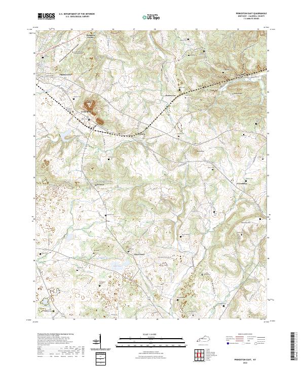
2022 Map of Princeton East
USGS Topo · Published 2022About this map
Cedar Bluff and the surrounding Caldwell County landscape are defined by a network of small family burial grounds and agricultural settlements. The eastern outskirts of Princeton transition into a karst-influenced terrain where features like Otter Pond and Groom Spring indicate the local hydrology. This 2022 edition documents the enduring rural character of communities such as Scottsburg, Claxton, and Friendship, while also showing modern infrastructure like the Princeton-Caldwell County Airport. Transportation history is visible in the alignment of the Old Railroad Bed Rd, which cuts through the high ground of Wildcat Ridge. Genealogists will find a high density of small cemeteries, including the Wadlington Cem, Rowland Cem, and Ashby Cem, providing a precise record of the area's ancestral landmarks and family plots.
Find a feature on this map
116 named features on this map. Tap any name to fly to it.
Don’t see what you’re looking for? This feature index may not catch every label — zoom into the map to look around manually.
Map Details
Editions of this 2022 Princeton East Map
This is the sole edition of this map. No revisions or reprints were ever made.
Other maps of this area

1908 · Princeton
USGS Topo · 1:62,500

1909 · Dawson Springs
USGS Topo · 1:48,000

1910 · Princeton
USGS Topo · 1:62,500

1911 · Dawson Springs
USGS Topo · 1:62,500

1953 · Gracey
USGS Topo · 1:24,000

1953 · Cobb
USGS Topo · 1:24,000

1953 · Dawson Springs SW
USGS Topo · 1:24,000
1953 · Lamasco
USGS Topo · 1:24,000

1954 · Evansville
USGS Topo · 1:250,000
1954 · Princeton West
USGS Topo · 1:24,000