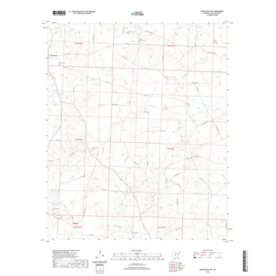
2020 Map of Princeton East
USGS Topo · Published 2020About this map
Princeton serves as the primary hub in this portion of Dallas County, where the historic Princeton Cem and Princeton Cem mark the local heritage. The landscape is defined by an intricate network of drainage basins, with Hurricane Cr and White Oak Cr carving through the terrain. Evidence of rural life and genealogy is scattered across the landscape in the form of numerous small family or community burial grounds, including the Vetter-Kauffman Cem and Herring Cem. A complex system of timber and local roads like Eagle Tram Rd and Dallas 101 connects the settlement of Eagletie to the surrounding hills. The map illustrates a region deeply tied to its natural waterways, such as Zion Cr and Mitchell Br, which dictate the placement of local homesteads and historical cemeteries like Tanyard Cem and Liberty Cem.
Find a feature on this map
64 named features on this map. Tap any name to fly to it.
Don’t see what you’re looking for? This feature index may not catch every label — zoom into the map to look around manually.
Map Details
Editions of this 2020 Princeton East Map
This is the sole edition of this map. No revisions or reprints were ever made.
Other maps of this area

1903 · Camden
USGS Topo · 1:125,000

1953 · El Dorado
USGS Topo · 1:250,000

1955 · Little Rock
USGS Topo · 1:250,000

1956 · Little Rock
USGS Topo · 1:250,000

1957 · El Dorado
USGS Topo · 1:250,000

1958 · El Dorado
USGS Topo · 1:250,000

1960 · El Dorado
USGS Topo · 1:250,000

1960 · Little Rock
USGS Topo · 1:250,000

1964 · Little Rock
USGS Topo · 1:250,000

1964 · Bunn
USGS Topo · 1:24,000