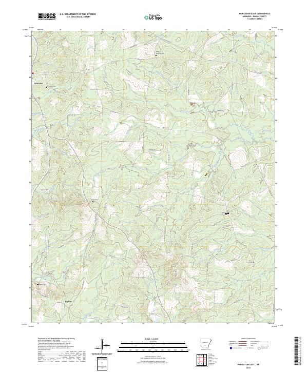
2024 Map of Princeton East
USGS Topo · Published 2024About this map
Princeton sits at the northern edge of this Dallas County landscape, serving as a focal point for a region defined by its dense network of small waterways and local roads. The terrain is intricately carved by streams such as Garner Creek, Barlow Creek, and Simmons Creek, which create a complex drainage pattern throughout the area. For genealogists, the map is remarkably dense with burial sites, including the Princeton Cem, Vetter - Kauffman Cem, and Tanyard Cem near the center of the survey.
Find a feature on this map
65 named features on this map. Tap any name to fly to it.
Don’t see what you’re looking for? This feature index may not catch every label — zoom into the map to look around manually.
Map Details
Editions of this 2024 Princeton East Map
This is the sole edition of this map. No revisions or reprints were ever made.
Other maps of this area

1903 · Camden
USGS Topo · 1:125,000

1953 · El Dorado
USGS Topo · 1:250,000

1955 · Little Rock
USGS Topo · 1:250,000

1956 · Little Rock
USGS Topo · 1:250,000

1957 · El Dorado
USGS Topo · 1:250,000

1958 · El Dorado
USGS Topo · 1:250,000

1960 · El Dorado
USGS Topo · 1:250,000

1960 · Little Rock
USGS Topo · 1:250,000

1964 · Little Rock
USGS Topo · 1:250,000

1964 · Bunn
USGS Topo · 1:24,000