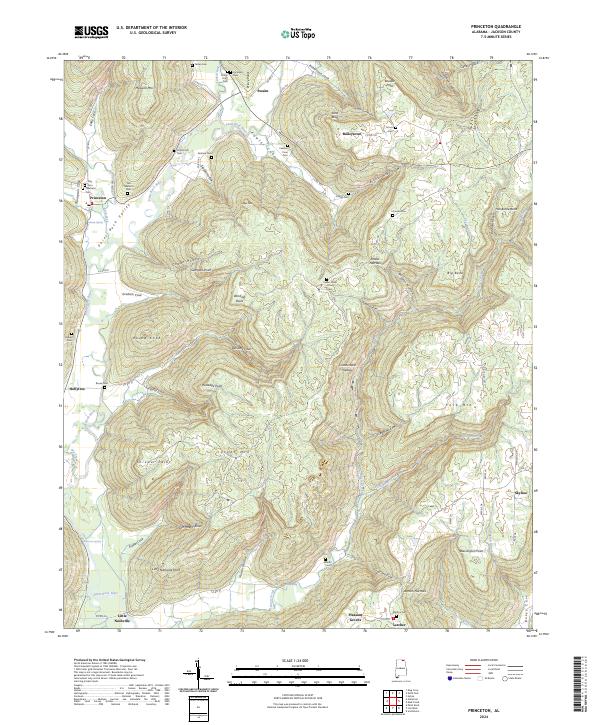
2024 Map of Princeton
USGS Topo · Published 2024About this map
Paint Rock River and its tributary, Larkin Fork, carve through the complex topography of the Cumberland Plateau in this Jackson County region. The landscape is defined by deep incisions such as Fowler Cove and Cowan Hollow, where small settlements like Princeton and Baileytown are situated along the valley floors. The distribution of numerous family and community burial sites, including Old Taliaferro Cem and Indian Grave Pond Cem, suggests a long-standing pattern of rural habitation tucked into the coves and along the ridge lines.
Find a feature on this map
107 named features on this map. Tap any name to fly to it.
Don’t see what you’re looking for? This feature index may not catch every label — zoom into the map to look around manually.
Map Details
Editions of this 2024 Princeton Map
This is the sole edition of this map. No revisions or reprints were ever made.
Other maps of this area

1888 · Scottsboro
USGS Topo · 1:125,000

1892 · Scottsboro
USGS Topo · 1:125,000

1936 · Scottsboro
USGS Topo · 1:24,000

1936 · King Cove
USGS Topo · 1:24,000

1936 · Hollytree
USGS Topo · 1:24,000

1936 · Mud Creek
USGS Topo · 1:24,000

1936 · Hytop
USGS Topo · 1:24,000

1936 · Princeton
USGS Topo · 1:24,000

1936 · Lim Rock
USGS Topo · 1:24,000
1936 · Paint Rock
USGS Topo · 1:24,000