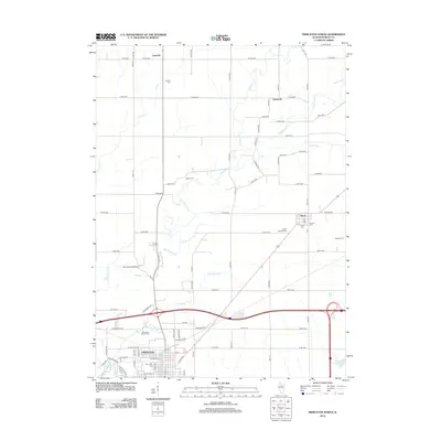
2012 Map of Princeton North
USGS Topo · Published 2012About this map
Princeton serves as the southern anchor for this Bureau County landscape, which transitions from organized town grids to the winding paths of Big Bureau Cr and its tributaries. The northern outskirts of the city are marked by historical burial grounds including Elm Lawn Cem and Woodlawn Stoner Cem, reflecting generations of local family history. Just to the north, the iconic Red Covered Bridge spans the creek, a notable landmark near the junction of rural routes like Co RD-1900.
Find a feature on this map
75 named features on this map. Tap any name to fly to it.
Don’t see what you’re looking for? This feature index may not catch every label — zoom into the map to look around manually.
Map Details
Editions of this 2012 Princeton North Map
This is the sole edition of this map. No revisions or reprints were ever made.
Other maps of this area

1893 · Hennepin
USGS Topo · 1:62,500

1909 · Hennepin
USGS Topo · 1:62,500

1911 · Hennepin
USGS Topo · 1:62,500

1921 · Buda
USGS Topo · 1:62,500

1923 · Buda
USGS Topo · 1:62,500

1949 · Walnut
USGS Topo · 1:62,500

1951 · Amboy
USGS Topo · 1:62,500

1958 · Aurora
USGS Topo · 1:250,000

1961 · Aurora
USGS Topo · 1:250,000
1966 · Malden
USGS Topo · 1:24,000