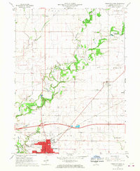
1966 Map of Princeton North
USGS Topo · Published 1968About this map
Princeton serves as the primary hub of this north-central Illinois landscape, showing significant mid-century growth near the intersection of the Chicago Burlington and Quincy railroad and major highways. To the north, the small settlements of Limerick and Dover anchor a rural expanse defined by the winding course of Big Bureau Creek. The creek valley is marked by a notable Covered Bridge and the City County Park, suggesting a longstanding local focus on the waterway for recreation and transit.
Find a feature on this map
36 named features on this map. Tap any name to fly to it.
Don’t see what you’re looking for? This feature index may not catch every label — zoom into the map to look around manually.
Map Details
Editions of this 1966 Princeton North Map
2 editions found
Other maps of this area

1893 · Hennepin
USGS Topo · 1:62,500

1909 · Hennepin
USGS Topo · 1:62,500

1911 · Hennepin
USGS Topo · 1:62,500

1921 · Buda
USGS Topo · 1:62,500

1923 · Buda
USGS Topo · 1:62,500

1949 · Walnut
USGS Topo · 1:62,500

1951 · Amboy
USGS Topo · 1:62,500

1958 · Aurora
USGS Topo · 1:250,000

1961 · Aurora
USGS Topo · 1:250,000
1966 · Malden
USGS Topo · 1:24,000