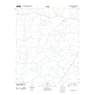
2011 Map of Princeton West
USGS Topo · Published 2011About this map
Jacinto anchors the southeastern corner of this Dallas County landscape, where the headwaters of numerous creeks converge. The terrain is defined by an intricate drainage system including the West Fork Tulip Creek and East Fork Tulip Creek, which carve through the countryside alongside White Oak Creek and Bear Creek. This network of waterways historically influenced the placement of local homesteads and travel routes, many of which remain today as an established grid of county roads.
Find a feature on this map
57 named features on this map. Tap any name to fly to it.
Don’t see what you’re looking for? This feature index may not catch every label — zoom into the map to look around manually.
Map Details
Editions of this 2011 Princeton West Map
This is the sole edition of this map. No revisions or reprints were ever made.
Other maps of this area

1903 · Camden
USGS Topo · 1:125,000

1953 · El Dorado
USGS Topo · 1:250,000

1955 · Little Rock
USGS Topo · 1:250,000

1956 · Little Rock
USGS Topo · 1:250,000

1957 · El Dorado
USGS Topo · 1:250,000

1958 · El Dorado
USGS Topo · 1:250,000

1960 · El Dorado
USGS Topo · 1:250,000

1960 · Little Rock
USGS Topo · 1:250,000

1964 · Little Rock
USGS Topo · 1:250,000
1965 · Manning
USGS Topo · 1:24,000