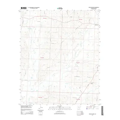
2014 Map of Princeton West
USGS Topo · Published 2014About this map
Princeton and Jacinto anchor the landscape of this Arkansas survey, situated amidst a complex network of waterways that define the local geography. The area is characterized by the convergence of several major tributaries, including the W Fork Tulip Cr and E Fork Tulip Cr, which feed into lower marshlands such as Hickory Flats Slough and Alsobrook Slough. This saturation of the landscape with slow-moving water and seasonal sloughs like Black Slough suggests a terrain that has historically shaped local land use and transportation routes.
Find a feature on this map
52 named features on this map. Tap any name to fly to it.
Don’t see what you’re looking for? This feature index may not catch every label — zoom into the map to look around manually.
Map Details
Editions of this 2014 Princeton West Map
This is the sole edition of this map. No revisions or reprints were ever made.
Other maps of this area

1903 · Camden
USGS Topo · 1:125,000

1953 · El Dorado
USGS Topo · 1:250,000

1955 · Little Rock
USGS Topo · 1:250,000

1956 · Little Rock
USGS Topo · 1:250,000

1957 · El Dorado
USGS Topo · 1:250,000

1958 · El Dorado
USGS Topo · 1:250,000

1960 · El Dorado
USGS Topo · 1:250,000

1960 · Little Rock
USGS Topo · 1:250,000

1964 · Little Rock
USGS Topo · 1:250,000
1965 · Manning
USGS Topo · 1:24,000