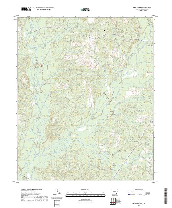
2024 Map of Princeton West
USGS Topo · Published 2024About this map
Princeton sits at the northeastern edge of this landscape, anchoring a rural expanse in Dallas County defined by the intricate drainage systems of the West Fork Tulip Creek and East Fork Tulip Creek. The terrain is characterized by numerous low-lying wetlands and sloughs, such as Alsobrook Slough and Black Slough, which suggest a seasonally variable water table and a history of timber or agricultural use adapted to the bottomlands. Small family or community burial grounds, including Henderson Cem, Herring Cem, and Taylor Cem, are dispersed across the quadrangle, providing critical touchpoints for genealogical research in this part of Arkansas.
Find a feature on this map
53 named features on this map. Tap any name to fly to it.
Don’t see what you’re looking for? This feature index may not catch every label — zoom into the map to look around manually.
Map Details
Editions of this 2024 Princeton West Map
This is the sole edition of this map. No revisions or reprints were ever made.
Other maps of this area

1903 · Camden
USGS Topo · 1:125,000

1953 · El Dorado
USGS Topo · 1:250,000

1955 · Little Rock
USGS Topo · 1:250,000

1956 · Little Rock
USGS Topo · 1:250,000

1957 · El Dorado
USGS Topo · 1:250,000

1958 · El Dorado
USGS Topo · 1:250,000

1960 · El Dorado
USGS Topo · 1:250,000

1960 · Little Rock
USGS Topo · 1:250,000

1964 · Little Rock
USGS Topo · 1:250,000
1965 · Manning
USGS Topo · 1:24,000