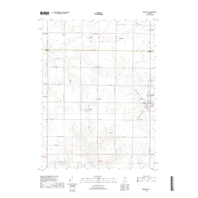
2018 Map of Princeville
USGS Topo · Published 2018About this map
The village of Princeville serves as the primary hub of this north-central Illinois landscape, where the agricultural grid is interrupted by the meandering course of the Spoon River and its various tributaries. This 2018 survey documents a region defined by its farming heritage and small-town centers like Monica and Duncan. For local historians and genealogists, the map provides precise locations for numerous rural burial grounds, including Stringtown Cem, Schiebel Cem, and Princeville Township Cem, reflecting the early settlement patterns of Peoria and Stark counties. The terrain is drained by several named waterways such as Indian Cr and Jubilee Cr, while landmarks like the Slackwater Bridge indicate the historical importance of river crossings. The layout of streets in the town center, from W Main St to S Santa Fe Ave, shows the traditional rail-and-road orientation typical of the Prairie State.
Find a feature on this map
75 named features on this map. Tap any name to fly to it.
Don’t see what you’re looking for? This feature index may not catch every label — zoom into the map to look around manually.
Map Details
Editions of this 2018 Princeville Map
This is the sole edition of this map. No revisions or reprints were ever made.
Other maps of this area

1893 · Dunlap
USGS Topo · 1:62,500

1898 · Dunlap
USGS Topo · 1:62,500

1932 · Dunlap
USGS Topo · 1:62,500

1933 · Dunlap
USGS Topo · 1:62,500

1933 · Camp Grove
USGS Topo · 1:48,000

1937 · Dunlap
USGS Topo · 1:62,500

1944 · Kewanee
USGS Topo · 1:62,500

1944 · Elmwood
USGS Topo · 1:62,500

1945 · Bradford
USGS Topo · 1:62,500

1948 · Elmwood
USGS Topo · 1:62,500