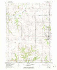
1982 Map of Princeville
USGS Topo · Published 1983About this map
Princeville and the surrounding Peoria County prairies are defined by a strict grid of section lines and essential rail corridors in this early 1980s study. The Atchison Topeka and Santa Fe and Burlington Northern railroads intersect the landscape, anchoring small agricultural hubs like Monica and Duncan. The terrain transitions from flat farmland to more varied relief where the Spoon River and Indian Creek cut through the northwest, while Jubilee Creek and Prince Run drain the southern and eastern reaches. Genealogists can find numerous family and community burial sites, including Stringtown Cem, Schiebel Cem, and Walliker Cem, which are scattered across the townships of West Jersey, Princeville, and Akron. The presence of Phils Airstrip and several local sandpits reflects the small-scale infrastructure supporting this rural Illinois community.
Find a feature on this map
28 named features on this map. Tap any name to fly to it.
Don’t see what you’re looking for? This feature index may not catch every label — zoom into the map to look around manually.
Map Details
Editions of this 1982 Princeville Map
This is the sole edition of this map. No revisions or reprints were ever made.
Other maps of this area

1893 · Dunlap
USGS Topo · 1:62,500

1898 · Dunlap
USGS Topo · 1:62,500

1932 · Dunlap
USGS Topo · 1:62,500

1933 · Dunlap
USGS Topo · 1:62,500

1933 · Camp Grove
USGS Topo · 1:48,000

1937 · Dunlap
USGS Topo · 1:62,500

1944 · Kewanee
USGS Topo · 1:62,500

1944 · Elmwood
USGS Topo · 1:62,500

1945 · Bradford
USGS Topo · 1:62,500

1948 · Elmwood
USGS Topo · 1:62,500