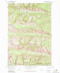
1966 Map of Printz Ridge
USGS Topo · Published 1984About this map
Bitterroot National Forest defines this high mountain landscape, where steep ridges and narrow canyons provide a stark look at the Montana backcountry in the mid-1960s. The topography is dominated by parallel east-west drainage systems including Fred Burr Creek, Sheafman Creek, Mill Creek, and Blodgett Creek. These waterways originate near the high peaks of the Selway-Bitterroot Wilderness boundary, flowing past prominent landmarks like Castle Crag and Mill Point. The human presence is primarily marked by a network of pack trails, such as the Blodgett Pack Trail and Sheafman Pack Trail, which provide the only access to the numerous alpine lakes scattered through the terrain, including High Lake, Sheafman Lake, and Sears Lake. A single notable impoundment, the Fred Burr Res, sits at the northern end of the quadrangle below Printz Ridge.
Find a feature on this map
34 named features on this map. Tap any name to fly to it.
Don’t see what you’re looking for? This feature index may not catch every label — zoom into the map to look around manually.
Map Details
Editions of this 1966 Printz Ridge Map
2 editions found
Other maps of this area

1901 · Hamilton
USGS Topo · 1:125,000

1956 · Hamilton
USGS Topo · 1:250,000

1959 · Hamilton
USGS Topo · 1:250,000

1960 · Hamilton
USGS Topo · 1:250,000

1964 · Hamilton
USGS Topo · 1:250,000

1964 · Hamilton South
USGS Topo · 1:24,000

1964 · Tenmile Lake
USGS Topo · 1:24,000

1964 · Ward Mountain
USGS Topo · 1:24,000
1966 · Blodgett Mtn
USGS Topo · 1:24,000
1966 · White Sand Lake
USGS Topo · 1:24,000