Loading...
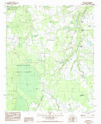
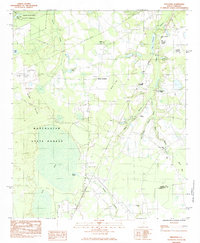
Loading map...1983 Map of Privateer
USGS Topo · Published 1988About this map
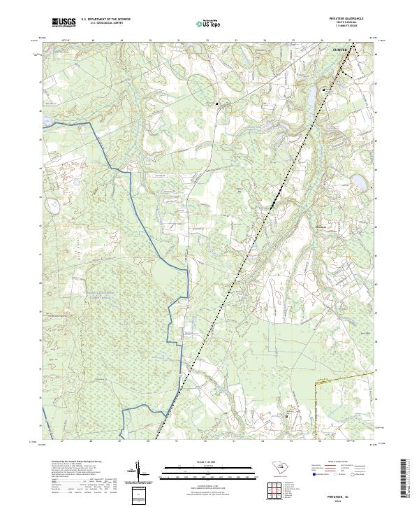
Manchester State Forest dominates the western landscape of this South Carolina quadrangle, where the Sand Hills give way to the intricate wetland systems of the coastal plain. The map reveals a transition from the managed timberlands and an Air to Ground Artillary Range in the west to a more densely settled agricultural and residential corridor along the Seaboard line. Settlements like Privateer and Harvins Crossroads serve as local hubs, connected by a network of rural roads that cross drainages such as Sammy Swamp and Brunson Swamp.
Find a feature on this map
36 named features on this map. Tap any name to fly to it.
Don’t see what you’re looking for? This feature index may not catch every label — zoom into the map to look around manually.
Map Details
Date Portrayed1983
Date Published1988
PublisherU.S. Geological Survey
Map TypeTopographic
Scale1:24,000
Physical Dimensions22 x 26.8 inches
Editions of this 1983 Privateer Map
2 editions found
Historical Maps of Sumter Through Time
6 maps found
Featured Locations
Source Details
SourceU.S. Geological Survey
CopyrightPublic Domain