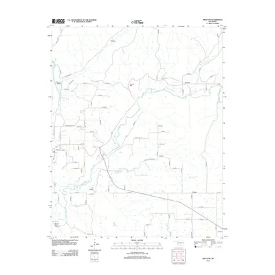
2012 Map of Proctor
USGS Topo · Published 2012About this map
Proctor Mtn overlooks the winding course of the Baron Fork in this portion of Cherokee County, where small rural communities are defined by the rugged Ozark foothills. The settlement of Proctor sits at a crossing point of the river, while other named locales like Titanic and Pumpkin Hollow dot the surrounding countryside. This landscape is marked by a network of drainage hollows such as Field Hollow and Mining Camp Hollow, the latter hinting at the area's historical extraction efforts. Genealogists will find notable burial sites including the Pumpkin Center Cem and Cedar Tree Cem. The presence of several branches, such as Wall Trip Br and Willow Br Cr, alongside the Illinois River, illustrates the complex hydrology that has shaped local settlement patterns and road networks like E McLemore Hollow Rd.
Find a feature on this map
74 named features on this map. Tap any name to fly to it.
Don’t see what you’re looking for? This feature index may not catch every label — zoom into the map to look around manually.
Map Details
Editions of this 2012 Proctor Map
This is the sole edition of this map. No revisions or reprints were ever made.
Other maps of this area

1898 · Tahlequah
USGS Topo · 1:125,000

1899 · Siloam Springs
USGS Topo · 1:125,000

1901 · Tahlequah
USGS Topo · 1:125,000

1903 · Siloam Springs
USGS Topo · 1:125,000

1904 · Siloam Springs
USGS Topo · 1:125,000

1905 · Tahlequah
USGS Topo · 1:125,000

1946 · Fort Smith
USGS Topo · 1:250,000

1954 · Tulsa
USGS Topo · 1:250,000

1958 · Tulsa
USGS Topo · 1:250,000

1963 · Tulsa
USGS Topo · 1:250,000