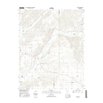
2016 Map of Proctor
USGS Topo · Published 2016About this map
The Baron Fork waterway carves a significant path through the hills of eastern Oklahoma, defining the landscape between Eldon and Proctor. This area, situated along the Cherokee Co and Adair Co boundary, exhibits a settlement pattern deeply tied to the narrow valleys and hollows, such as Pumpkin Hollow and Field Hollow. The presence of numerous small family and neighborhood burial sites, including the Cobb Family Cem and Shirley Cem, provides a detailed record of local lineage across the countryside. Higher elevations like Proctor Mtn and Eldon Mtn overlook the winding river valley, where roads like E 745 Rd and Collins Rd connect rural communities like Welling and the uniquely named Titanic. The convergence of the Illinois River and its tributaries underscores the importance of drainage and terrain in shaping the development of these Ozark foothills.
Find a feature on this map
80 named features on this map. Tap any name to fly to it.
Don’t see what you’re looking for? This feature index may not catch every label — zoom into the map to look around manually.
Map Details
Editions of this 2016 Proctor Map
This is the sole edition of this map. No revisions or reprints were ever made.
Other maps of this area

1898 · Tahlequah
USGS Topo · 1:125,000

1899 · Siloam Springs
USGS Topo · 1:125,000

1901 · Tahlequah
USGS Topo · 1:125,000

1903 · Siloam Springs
USGS Topo · 1:125,000

1904 · Siloam Springs
USGS Topo · 1:125,000

1905 · Tahlequah
USGS Topo · 1:125,000

1946 · Fort Smith
USGS Topo · 1:250,000

1954 · Tulsa
USGS Topo · 1:250,000

1958 · Tulsa
USGS Topo · 1:250,000

1963 · Tulsa
USGS Topo · 1:250,000