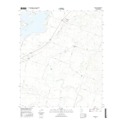
2016 Map of Proctor
USGS Topo · Published 2016About this map
Proctor Lake dominates the northwest corner of this central Texas landscape, where the waters of the Leon River are impounded. The settlement of Proctor sits just east of the lake's spillway, serving as a focal point for the surrounding rural road network. To the southwest, the community of Hasse is situated along a major highway corridor. The map reveals a deeply rooted history through its numerous family and community burial grounds, including Reid Cem, Miller Cem, and Luker Cem.
Find a feature on this map
54 named features on this map. Tap any name to fly to it.
Don’t see what you’re looking for? This feature index may not catch every label — zoom into the map to look around manually.
Map Details
Editions of this 2016 Proctor Map
This is the sole edition of this map. No revisions or reprints were ever made.
Other maps of this area

1888 · Hamilton
USGS Topo · 1:125,000

1889 · Brownwood
USGS Topo · 1:125,000

1890 · Stephenville
USGS Topo · 1:125,000

1894 · Hamilton
USGS Topo · 1:125,000

1894 · Eastland
USGS Topo · 1:125,000

1894 · Brownwood
USGS Topo · 1:125,000

1920 · Stephenville
USGS Topo · 1:125,000

1954 · Brownwood
USGS Topo · 1:250,000

1954 · Abilene
USGS Topo · 1:250,000

1956 · Gustine
USGS Topo · 1:62,500