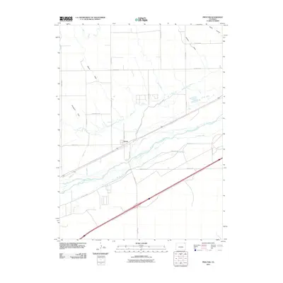
2010 Map of Proctor
USGS Topo · Published 2010About this map
The settlement of Proctor sits at the heart of an intricate irrigation network along the South Platte River in Logan County. This landscape is defined by the sophisticated water management systems required for agriculture on the high plains, evidenced by the dense grid of channels including the Powell Ditch, Harmony Ditch Number 1, and Sam Rice Ditch. These man-made waterways crisscross the river valley, serving the surrounding farmland where the terrain is otherwise shaped by natural drainages like Skinner Draw and Simpsons Draw. The map reveals how the rural road system, from County Rd 50 to County Rd 67, navigates around these vital water routes and the Sterling Outlet Canal. This 2010 survey illustrates the continued importance of historical water rights and infrastructure in sustaining the community of Proctor and its valley neighbors.
Find a feature on this map
36 named features on this map. Tap any name to fly to it.
Don’t see what you’re looking for? This feature index may not catch every label — zoom into the map to look around manually.
Map Details
Editions of this 2010 Proctor Map
This is the sole edition of this map. No revisions or reprints were ever made.
Other maps of this area

1951 · Galien
USGS Topo · 1:24,000

1951 · Iliff
USGS Topo · 1:24,000

1953 · Peetz
USGS Topo · 1:24,000

1953 · Crook
USGS Topo · 1:24,000

1953 · Twin Buttes
USGS Topo · 1:24,000

1953 · Proctor
USGS Topo · 1:24,000

1953 · Haystack Butte
USGS Topo · 1:24,000

1954 · Sterling
USGS Topo · 1:250,000

1958 · Sterling
USGS Topo · 1:250,000

1962 · Fleming
USGS Topo · 1:24,000