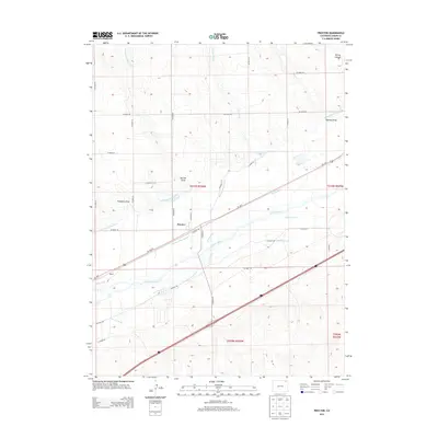
2013 Map of Proctor
USGS Topo · Published 2013About this map
The settlement of Proctor serves as the focal point for this section of Logan County, positioned within a landscape defined by the complex water management systems of the South Platte River valley. This 2013 survey illustrates the extensive network of irrigation infrastructure essential to Colorado agriculture, featuring the Harmony Ditch Number 2, Ramsey Ditch, and the Iliff Platte Valley Ditch. The S Platte River meanders through the central portion of the map, flanked by numerous named waterways such as Lone Tree Ditch and Chambers Ditch. To the north, the terrain transitions into more pronounced relief with features like Simpsons Draw and Skinner Draw. The area is further delineated by a strict grid of county roads and the corridor of Us-138 E, which mirrors the historical path of transport and commerce through this prairie region.
Find a feature on this map
39 named features on this map. Tap any name to fly to it.
Don’t see what you’re looking for? This feature index may not catch every label — zoom into the map to look around manually.
Map Details
Editions of this 2013 Proctor Map
This is the sole edition of this map. No revisions or reprints were ever made.
Other maps of this area

1951 · Galien
USGS Topo · 1:24,000

1951 · Iliff
USGS Topo · 1:24,000

1953 · Peetz
USGS Topo · 1:24,000

1953 · Crook
USGS Topo · 1:24,000

1953 · Twin Buttes
USGS Topo · 1:24,000

1953 · Proctor
USGS Topo · 1:24,000

1953 · Haystack Butte
USGS Topo · 1:24,000

1954 · Sterling
USGS Topo · 1:250,000

1958 · Sterling
USGS Topo · 1:250,000

1962 · Fleming
USGS Topo · 1:24,000