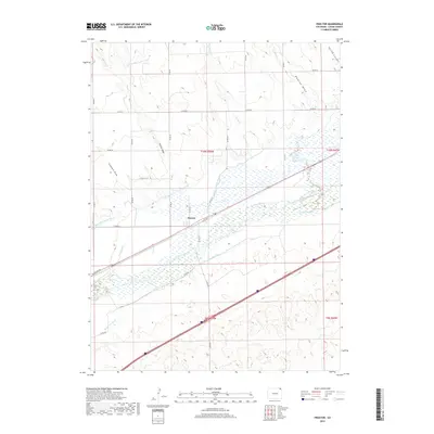
2019 Map of Proctor
USGS Topo · Published 2019About this map
Proctor sits at the heart of this landscape, positioned along the Union Pacific line in Logan County. This area is defined by an intricate network of water management, where the South Platte River is flanked by a complex system of canals and ditches designed to sustain agriculture in the eastern plains. Numerous named water routes, such as Harmony Ditch Number 2, Ramsey Ditch, and Sam Rice Ditch, crisscross the terrain, reflecting the vital importance of irrigation in this region. The landscape transitions from the river valley to higher ground marked by seasonal drainages like Simpsons Draw and Skinner Draw. To the north, the N Sterling Outlet Canal cuts through the plains, while Railroad Ave provides a direct link to the transportation corridor that helped establish the settlement.
Find a feature on this map
37 named features on this map. Tap any name to fly to it.
Don’t see what you’re looking for? This feature index may not catch every label — zoom into the map to look around manually.
Map Details
Editions of this 2019 Proctor Map
This is the sole edition of this map. No revisions or reprints were ever made.
Other maps of this area

1951 · Galien
USGS Topo · 1:24,000

1951 · Iliff
USGS Topo · 1:24,000

1953 · Peetz
USGS Topo · 1:24,000

1953 · Crook
USGS Topo · 1:24,000

1953 · Twin Buttes
USGS Topo · 1:24,000

1953 · Proctor
USGS Topo · 1:24,000

1953 · Haystack Butte
USGS Topo · 1:24,000

1954 · Sterling
USGS Topo · 1:250,000

1958 · Sterling
USGS Topo · 1:250,000

1962 · Fleming
USGS Topo · 1:24,000