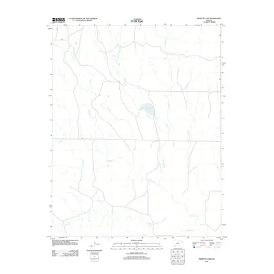
2012 Map of Proffitt Lake
USGS Topo · Published 2012About this map
Proffitt Lake serves as a central landmark in this southwestern Kansas landscape, where a network of seasonal and perennial drainages carves through the high plains. The drainage pattern is defined by several significant watercourses, including Big Sandy Cr, Twomile Cr, and Johns Cr, which flow across a largely open territory. A modest grid of rural roads, including Q RD and U RD, provides access to this corner of Meade County, reflecting the sparse settlement patterns typical of the region's agricultural and ranching economy in the early 21st century. The map highlights the intersection of natural hydrology and human infrastructure, such as where 283 crosses the upper reaches of Indian Cr and Gyp Cr in the northern portion of the quadrangle.
Find a feature on this map
11 named features on this map. Tap any name to fly to it.
Don’t see what you’re looking for? This feature index may not catch every label — zoom into the map to look around manually.
Map Details
Editions of this 2012 Proffitt Lake Map
This is the sole edition of this map. No revisions or reprints were ever made.
Other maps of this area

1892 · Meade
USGS Topo · 1:125,000

1896 · Ashland
USGS Topo · 1:125,000

1955 · Pratt
USGS Topo · 1:250,000

1955 · Dodge City
USGS Topo · 1:250,000

1958 · Dodge City
USGS Topo · 1:250,000

1959 · Pratt
USGS Topo · 1:250,000

1959 · Dodge City
USGS Topo · 1:250,000

1967 · Fowler SE
USGS Topo · 1:24,000

1967 · Fowler SW
USGS Topo · 1:24,000

1972 · Ashland NW
USGS Topo · 1:24,000